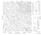
Maps showing Roaring Bull Rapids, Yukon
Roaring Bull Rapids is a Rapids located in Yukon and has an elevation of 698 meters.
- Latitude: 61° 4' 00'' North (decimal: 61.0666666)
- Longitude: 134° 14' 55'' West (decimal: -134.2486111)
- Topography Feature Category: Rapids
- Geographical Feature: Rapids
- Canadian Province/Territory: Yukon
- Elevation: 698 meters
- Atlas of Canada Locator Map: Roaring Bull Rapids
- GPS Coordinate Locator Map: Roaring Bull Rapids Lat/Long
Roaring Bull Rapids NTS Map Sheets