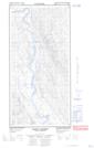
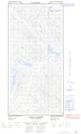
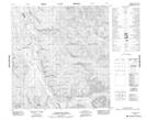
Maps showing St. Germain Creek, Yukon
St. Germain Creek is a River located in Yukon and has an elevation of 925 meters.
- Latitude: 61° 24' 50'' North (decimal: 61.4138888)
- Longitude: 134° 22' 54'' West (decimal: -134.3816667)
- Topography Feature Category: River
- Geographical Feature: Creek
- Canadian Province/Territory: Yukon
- Elevation: 925 meters
- Atlas of Canada Locator Map: St. Germain Creek
- GPS Coordinate Locator Map: St. Germain Creek Lat/Long
St. Germain Creek NTS Map Sheets