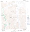
Maps showing Seela Pass, Yukon
Seela Pass is a Valley located in Yukon and has an elevation of 1090 meters.
- Latitude: 64° 40' 14'' North (decimal: 64.6705555)
- Longitude: 138° 58' 16'' West (decimal: -138.9711111)
- Topography Feature Category: Valley
- Geographical Feature: Pass
- Canadian Province/Territory: Yukon
- Elevation: 1090 meters
- Atlas of Canada Locator Map: Seela Pass
- GPS Coordinate Locator Map: Seela Pass Lat/Long