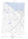
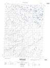
Maps showing Shingle Point, Yukon
Shingle Point is a Unincorporated area located in Yukon.
- Latitude: 68° 59' 23'' North (decimal: 68.9897222)
- Longitude: 137° 21' 41'' West (decimal: -137.3613889)
- Topography Feature Category: Unincorporated area
- Geographical Feature: Settlement
- Canadian Province/Territory: Yukon
- GPS Coordinate Locator Map: Shingle Point Lat/Long
Shingle Point NTS Map Sheets