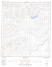
Maps showing South Bear Creek, Yukon
South Bear Creek is a River located in Yukon.
- Latitude: 63° 38' 28'' North (decimal: 63.6411111)
- Longitude: 136° 35' 50'' West (decimal: -136.5972222)
- Topography Feature Category: River
- Geographical Feature: Creek
- Canadian Province/Territory: Yukon
- Atlas of Canada Locator Map: South Bear Creek
- GPS Coordinate Locator Map: South Bear Creek Lat/Long
South Bear Creek NTS Map Sheets