Maps showing Sulphur, Yukon
Sulphur is a Unincorporated area located in Yukon and has an elevation of 683 meters.
- Latitude: 63° 45' 34'' North (decimal: 63.7594444)
- Longitude: 138° 53' 31'' West (decimal: -138.8919444)
- Topography Feature Category: Unincorporated area
- Geographical Feature: Locality
- Canadian Province/Territory: Yukon
- Elevation: 683 meters
- Atlas of Canada Locator Map: Sulphur
- GPS Coordinate Locator Map: Sulphur Lat/Long
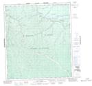
Sulphur NTS Map Sheets