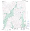
Maps showing Tombstone Pass, Yukon
Tombstone Pass is a Valley located in Yukon.
- Latitude: 64° 27' 15'' North (decimal: 64.4541666)
- Longitude: 138° 31' 55'' West (decimal: -138.5319444)
- Topography Feature Category: Valley
- Geographical Feature: Pass
- Canadian Province/Territory: Yukon
- Atlas of Canada Locator Map: Tombstone Pass
- GPS Coordinate Locator Map: Tombstone Pass Lat/Long
Tombstone Pass NTS Map Sheets