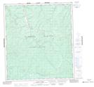
Maps showing Victoria Gulch, Yukon
Victoria Gulch is a Valley located in Yukon and has an elevation of 637 meters.
- Latitude: 63° 53' 56'' North (decimal: 63.8988888)
- Longitude: 139° 12' 36'' West (decimal: -139.21)
- Topography Feature Category: Valley
- Geographical Feature: Gulch
- Canadian Province/Territory: Yukon
- Elevation: 637 meters
- Atlas of Canada Locator Map: Victoria Gulch
- GPS Coordinate Locator Map: Victoria Gulch Lat/Long
Victoria Gulch NTS Map Sheets