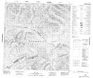
Maps showing West Blank Creek, Yukon
West Blank Creek is a River located in Yukon and has an elevation of 1089 meters.
- Latitude: 60° 24' 30'' North (decimal: 60.4083333)
- Longitude: 130° 53' 17'' West (decimal: -130.8880556)
- Topography Feature Category: River
- Geographical Feature: Creek
- Canadian Province/Territory: Yukon
- Elevation: 1089 meters
- Atlas of Canada Locator Map: West Blank Creek
- GPS Coordinate Locator Map: West Blank Creek Lat/Long