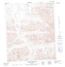
Maps showing Whitecrown Mountain, Yukon
Whitecrown Mountain is a Mountain located in Yukon.
- Latitude: 64° 32' 4'' North (decimal: 64.5344444)
- Longitude: 138° 21' 23'' West (decimal: -138.3563889)
- Topography Feature Category: Mountain
- Geographical Feature: Mountain
- Canadian Province/Territory: Yukon
- Atlas of Canada Locator Map: Whitecrown Mountain
- GPS Coordinate Locator Map: Whitecrown Mountain Lat/Long
Whitecrown Mountain NTS Map Sheets