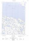
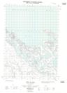
Maps showing Whitefish Station, Yukon
Whitefish Station is a Unincorporated area located in Yukon.
- Latitude: 68° 52' 41'' North (decimal: 68.8780555)
- Longitude: 136° 51' 21'' West (decimal: -136.8558333)
- Topography Feature Category: Unincorporated area
- Geographical Feature: Locality
- Canadian Province/Territory: Yukon
- Atlas of Canada Locator Map: Whitefish Station
- GPS Coordinate Locator Map: Whitefish Station Lat/Long
Whitefish Station NTS Map Sheets