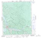
Maps showing 20 Pup, Yukon
20 Pup is a Valley located in Yukon and has an elevation of 454 meters.
- Latitude: 64° 1' 25'' North (decimal: 64.0236111)
- Longitude: 139° 8' 57'' West (decimal: -139.1491667)
- Topography Feature Category: Valley
- Geographical Feature: Pup
- Canadian Province/Territory: Yukon
- Elevation: 454 meters
- Atlas of Canada Locator Map: 20 Pup
- GPS Coordinate Locator Map: 20 Pup Lat/Long