Canada Topographic Maps

Artlewis Glacier Topo Maps

Topography maps and Latitude/Longitude Location

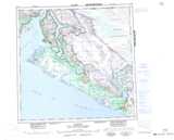
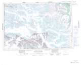
Maps showing Artlewis Glacier, Yukon

Artlewis Glacier is a Glacier located in Yukon.

  • Latitude: 60° 00' North   (decimal: 59.9999999)
  • Longitude: 139° 00' West   (decimal: -138.9999999)
  • Topography Feature Category: Glacier
  • Geographical Feature: Glacier
  • Canadian Province/Territory: Yukon
  • GPS Coordinate Locator Map: Artlewis Glacier Lat/Long

Artlewis Glacier NTS Map Sheets

114O15 Mount Aylesworth Topographic Map at 1:50,000 scale

115B02 Ulu Mountain Topographic Map at 1:50,000 scale

115B03 Mount Seattle Topographic Map at 1:50,000 scale

114O Yakutat Topographic Map at 1:250,000 scale

115B Mount St Elias Topographic Map at 1:250,000 scale

 
Buy Topographic Maps DVD
Newsletter Sign-up

Yes, I want to receive map store discounts.


Bookmark and Share