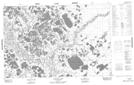
Maps showing Th{11}ch{23} G{25}nl{21}, Yukon
Th{11}ch{23} G{25}nl{21} is a Lake located in Yukon.
- Latitude: 68° 12' 34'' North (decimal: 68.2094444)
- Longitude: 139° 36' 20'' West (decimal: -139.6055556)
- Topography Feature Category: Lake
- Geographical Feature: Lake
- Canadian Province/Territory: Yukon
- Atlas of Canada Locator Map: Th{11}ch{23} G{25}nl{21}
- GPS Coordinate Locator Map: Th{11}ch{23} G{25}nl{21} Lat/Long
Th{11}ch{23} G{25}nl{21} NTS Map Sheets