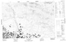
Maps showing Ch'in{24}kai Vàn, Yukon
Ch'in{24}kai Vàn is a Lake located in Yukon.
- Latitude: 68° 16' 44'' North (decimal: 68.2788888)
- Longitude: 139° 39' 12'' West (decimal: -139.6533333)
- Topography Feature Category: Lake
- Geographical Feature: Lake
- Canadian Province/Territory: Yukon
- Atlas of Canada Locator Map: Ch'in{24}kai Vàn
- GPS Coordinate Locator Map: Ch'in{24}kai Vàn Lat/Long
Ch'in{24}kai Vàn NTS Map Sheets