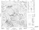
Maps showing {1}yó Ts'eda, Yukon
{1}yó Ts'eda is a River located in Yukon.
- Latitude: 61° 14' 28'' North (decimal: 61.2411111)
- Longitude: 134° 36' 54'' West (decimal: -134.615)
- Topography Feature Category: River
- Geographical Feature: Creek
- Canadian Province/Territory: Yukon
- Atlas of Canada Locator Map: {1}yó Ts'eda
- GPS Coordinate Locator Map: {1}yó Ts'eda Lat/Long
{1}yó Ts'eda NTS Map Sheets