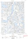
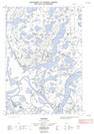
Maps showing Aklisuktuk Pingo, Mackenzie, Northwest Territories
Aklisuktuk Pingo is a Mountain located in Mackenzie, Northwest Territories and has an elevation of 28 meters.
- Latitude: 69° 4' 00'' North (decimal: 69.0665880)
- Longitude: 134° 20' 10'' West (decimal: -134.3360574)
- Topography Feature Category: Mountain
- Geographical Feature: Pingo
- Canadian Province/Territory: Northwest Territories
- Elevation: 28 meters
- Location: Mackenzie
- Atlas of Canada Locator Map: Aklisuktuk Pingo
- GPS Coordinate Locator Map: Aklisuktuk Pingo Lat/Long
Aklisuktuk Pingo NTS Map Sheets