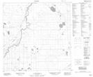
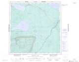
Maps showing Alexandra Falls, Mackenzie, Northwest Territories
Alexandra Falls is a Unincorporated area located in Mackenzie, Northwest Territories and has an elevation of 274 meters.
- Latitude: 60° 22' 0'' North (decimal: 60.3667776)
- Longitude: 116° 26' 5'' West (decimal: -116.4347149)
- Topography Feature Category: Unincorporated area
- Geographical Feature: Railway Point
- Canadian Province/Territory: Northwest Territories
- Elevation: 274 meters
- Location: Mackenzie
- Atlas of Canada Locator Map: Alexandra Falls
- GPS Coordinate Locator Map: Alexandra Falls Lat/Long
Alexandra Falls NTS Map Sheets