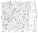
Maps showing Anderson Lake, Mackenzie, Northwest Territories
Anderson Lake is a Lake located in Mackenzie, Northwest Territories.
- Latitude: 61° 10' 1'' North (decimal: 61.1668389)
- Longitude: 108° 47' 3'' West (decimal: -108.7842200)
- Topography Feature Category: Lake
- Geographical Feature: Lake
- Canadian Province/Territory: Northwest Territories
- Location: Mackenzie
- Atlas of Canada Locator Map: Anderson Lake
- GPS Coordinate Locator Map: Anderson Lake Lat/Long
Anderson Lake NTS Map Sheets