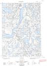
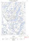
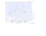
Maps showing Bad Creek, Mackenzie, Northwest Territories
Bad Creek is a River located in Mackenzie, Northwest Territories.
- Latitude: 69° 5' 20'' North (decimal: 69.0888111)
- Longitude: 134° 21' 50'' West (decimal: -134.3638333)
- Topography Feature Category: River
- Geographical Feature: Creek
- Canadian Province/Territory: Northwest Territories
- Location: Mackenzie
- Atlas of Canada Locator Map: Bad Creek
- GPS Coordinate Locator Map: Bad Creek Lat/Long
Bad Creek NTS Map Sheets