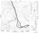
Maps showing Bell Rock, Mackenzie, Northwest Territories
Bell Rock is a Unincorporated area located in Mackenzie, Northwest Territories and has an elevation of 179 meters.
- Latitude: 60° 1' 26'' North (decimal: 60.0237569)
- Longitude: 112° 5' 34'' West (decimal: -112.0927394)
- Topography Feature Category: Unincorporated area
- Geographical Feature: Locality
- Canadian Province/Territory: Northwest Territories
- Elevation: 179 meters
- Location: Mackenzie
- Atlas of Canada Locator Map: Bell Rock
- GPS Coordinate Locator Map: Bell Rock Lat/Long
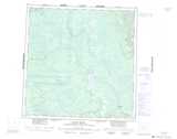
Bell Rock NTS Map Sheets