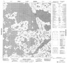
Maps showing Big Island, Mackenzie, Northwest Territories
Big Island is a Island located in Mackenzie, Northwest Territories.
- Latitude: 63° 54' 1'' North (decimal: 63.9002561)
- Longitude: 111° 20' 4'' West (decimal: -111.3344898)
- Topography Feature Category: Island
- Geographical Feature: Island
- Canadian Province/Territory: Northwest Territories
- Location: Mackenzie
- Atlas of Canada Locator Map: Big Island
- GPS Coordinate Locator Map: Big Island Lat/Long
Big Island NTS Map Sheets