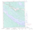
Maps showing Billy Creek, Mackenzie, Northwest Territories
Billy Creek is a River located in Mackenzie, Northwest Territories and has an elevation of 58 meters.
- Latitude: 65° 19' 55'' North (decimal: 65.3320089)
- Longitude: 127° 10' 2'' West (decimal: -127.1671525)
- Topography Feature Category: River
- Geographical Feature: Creek
- Canadian Province/Territory: Northwest Territories
- Elevation: 58 meters
- Location: Mackenzie
- Atlas of Canada Locator Map: Billy Creek
- GPS Coordinate Locator Map: Billy Creek Lat/Long
Billy Creek NTS Map Sheets