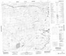
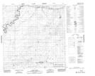
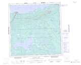
Maps showing Birch Creek, Mackenzie, Northwest Territories
Birch Creek is a River located in Mackenzie, Northwest Territories and has an elevation of 230 meters.
- Latitude: 60° 50' 5'' North (decimal: 60.8348521)
- Longitude: 115° 21' 50'' West (decimal: -115.3638348)
- Topography Feature Category: River
- Geographical Feature: Creek
- Canadian Province/Territory: Northwest Territories
- Elevation: 230 meters
- Location: Mackenzie
- Atlas of Canada Locator Map: Birch Creek
- GPS Coordinate Locator Map: Birch Creek Lat/Long
Birch Creek NTS Map Sheets