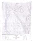
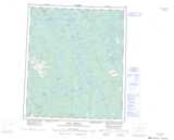
Maps showing Birch Island, Mackenzie, Northwest Territories
Birch Island is a Island located in Mackenzie, Northwest Territories and has an elevation of 121 meters.
- Latitude: 64° 10' 15'' North (decimal: 64.1709268)
- Longitude: 124° 25' 21'' West (decimal: -124.4225590)
- Topography Feature Category: Island
- Geographical Feature: Island
- Canadian Province/Territory: Northwest Territories
- Elevation: 121 meters
- Location: Mackenzie
- Atlas of Canada Locator Map: Birch Island
- GPS Coordinate Locator Map: Birch Island Lat/Long
Birch Island NTS Map Sheets