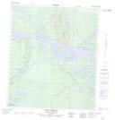
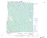
Maps showing Bluefish Creek, Mackenzie, Northwest Territories
Bluefish Creek is a River located in Mackenzie, Northwest Territories and has an elevation of 107 meters.
- Latitude: 64° 56' 0'' North (decimal: 64.9334287)
- Longitude: 125° 51' 1'' West (decimal: -125.8503920)
- Topography Feature Category: River
- Geographical Feature: Creek
- Canadian Province/Territory: Northwest Territories
- Elevation: 107 meters
- Location: Mackenzie
- Atlas of Canada Locator Map: Bluefish Creek
- GPS Coordinate Locator Map: Bluefish Creek Lat/Long
Bluefish Creek NTS Map Sheets