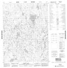
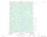
Maps showing Burnt Lake, Mackenzie, Northwest Territories
Burnt Lake is a Lake located in Mackenzie, Northwest Territories and has an elevation of 191 meters.
- Latitude: 67° 26' 0'' North (decimal: 67.4334219)
- Longitude: 128° 10' 8'' West (decimal: -128.1688655)
- Topography Feature Category: Lake
- Geographical Feature: Lake
- Canadian Province/Territory: Northwest Territories
- Elevation: 191 meters
- Location: Mackenzie
- Atlas of Canada Locator Map: Burnt Lake
- GPS Coordinate Locator Map: Burnt Lake Lat/Long
Burnt Lake NTS Map Sheets