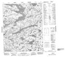
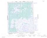
Maps showing Calder Lake, Mackenzie, Northwest Territories
Calder Lake is a Lake located in Mackenzie, Northwest Territories.
- Latitude: 65° 52' 1'' North (decimal: 65.8669659)
- Longitude: 115° 15' 5'' West (decimal: -115.2514576)
- Topography Feature Category: Lake
- Geographical Feature: Lake
- Canadian Province/Territory: Northwest Territories
- Location: Mackenzie
- Atlas of Canada Locator Map: Calder Lake
- GPS Coordinate Locator Map: Calder Lake Lat/Long
Calder Lake NTS Map Sheets