Canada Topographic Maps

Chelay Lake Topo Maps

Topography maps and Latitude/Longitude Location

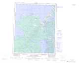
Maps showing Chelay Lake, Mackenzie, Northwest Territories

Chelay Lake is a Lake located in Mackenzie, Northwest Territories.

  • Latitude: 65° 14' 1'' North   (decimal: 65.2335700)
  • Longitude: 119° 26' 6'' West   (decimal: -119.4349844)
  • Topography Feature Category: Lake
  • Geographical Feature: Lake
  • Canadian Province/Territory: Northwest Territories
  • Location: Mackenzie
  • Atlas of Canada Locator Map: Chelay Lake
  • GPS Coordinate Locator Map: Chelay Lake Lat/Long

Chelay Lake NTS Map Sheets

086E03 Thomas Lake Topographic Map at 1:50,000 scale

086E04 Underwater Lake Topographic Map at 1:50,000 scale

086E05 Gordon Point Topographic Map at 1:50,000 scale

086E06 Fenwick Lake Topographic Map at 1:50,000 scale

086E Leith Peninsula Topographic Map at 1:250,000 scale

 
Buy Topographic Maps DVD
Newsletter Sign-up

Yes, I want to receive map store discounts.


Bookmark and Share