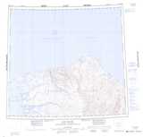
Maps showing Colquhoun Point, Franklin, Northwest Territories
Colquhoun Point is a Cape located in Franklin, Northwest Territories.
- Latitude: 74° 32' 2'' North (decimal: 74.5338784)
- Longitude: 121° 46' 12'' West (decimal: -121.7699579)
- Topography Feature Category: Cape
- Geographical Feature: Point
- Canadian Province/Territory: Northwest Territories
- Location: Franklin
- Atlas of Canada Locator Map: Colquhoun Point
- GPS Coordinate Locator Map: Colquhoun Point Lat/Long
Colquhoun Point NTS Map Sheets