Maps showing Dissection Creek, Northwest Territories
Dissection Creek is a River located in Northwest Territories and has an elevation of 36 meters.
- Latitude: 73° 15' 27'' North (decimal: 73.2574721)
- Longitude: 119° 36' 25'' West (decimal: -119.6069278)
- Topography Feature Category: River
- Geographical Feature: Creek
- Canadian Province/Territory: Northwest Territories
- Elevation: 36 meters
- GPS Coordinate Locator Map: Dissection Creek Lat/Long
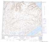
Dissection Creek NTS Map Sheets