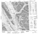
Maps showing Dolf Mountain, Mackenzie, Northwest Territories
Dolf Mountain is a Mountain located in Mackenzie, Northwest Territories and has an elevation of 1251 meters.
- Latitude: 62° 10' 00'' North (decimal: 62.1665661)
- Longitude: 127° 18' 6'' West (decimal: -127.3017446)
- Topography Feature Category: Mountain
- Geographical Feature: Mountain
- Canadian Province/Territory: Northwest Territories
- Elevation: 1251 meters
- Location: Mackenzie
- Atlas of Canada Locator Map: Dolf Mountain
- GPS Coordinate Locator Map: Dolf Mountain Lat/Long
Dolf Mountain NTS Map Sheets