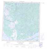
Maps showing Drever Lake, Mackenzie, Northwest Territories
Drever Lake is a Lake located in Mackenzie, Northwest Territories.
- Latitude: 62° 13' 1'' North (decimal: 62.2169290)
- Longitude: 112° 18' 4'' West (decimal: -112.3010832)
- Topography Feature Category: Lake
- Geographical Feature: Lake
- Canadian Province/Territory: Northwest Territories
- Location: Mackenzie
- Atlas of Canada Locator Map: Drever Lake
- GPS Coordinate Locator Map: Drever Lake Lat/Long
Drever Lake NTS Map Sheets