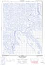
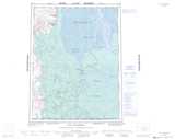
Maps showing Dry River, Mackenzie, Northwest Territories
Dry River is a Channel located in Mackenzie, Northwest Territories.
- Latitude: 67° 41' 00'' North (decimal: 67.6832068)
- Longitude: 134° 40' 9'' West (decimal: -134.6691148)
- Topography Feature Category: Channel
- Geographical Feature: Channel
- Canadian Province/Territory: Northwest Territories
- Location: Mackenzie
- Atlas of Canada Locator Map: Dry River
- GPS Coordinate Locator Map: Dry River Lat/Long
Dry River NTS Map Sheets