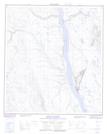
Maps showing Ducot Peak, Mackenzie, Northwest Territories
Ducot Peak is a Mountain located in Mackenzie, Northwest Territories and has an elevation of 634 meters.
- Latitude: 63° 18' 15'' North (decimal: 63.3042517)
- Longitude: 123° 55' 36'' West (decimal: -123.9266659)
- Topography Feature Category: Mountain
- Geographical Feature: Peak
- Canadian Province/Territory: Northwest Territories
- Elevation: 634 meters
- Location: Mackenzie
- Atlas of Canada Locator Map: Ducot Peak
- GPS Coordinate Locator Map: Ducot Peak Lat/Long
Ducot Peak NTS Map Sheets