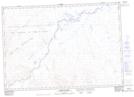
Maps showing Escape Reef, Mackenzie, Northwest Territories
Escape Reef is a Shoal located in Mackenzie, Northwest Territories.
- Latitude: 68° 59' 59'' North (decimal: 68.9998320)
- Longitude: 137° 12' 10'' West (decimal: -137.2026916)
- Topography Feature Category: Shoal
- Geographical Feature: Reef
- Canadian Province/Territory: Northwest Territories
- Location: Mackenzie
- Atlas of Canada Locator Map: Escape Reef
- GPS Coordinate Locator Map: Escape Reef Lat/Long
Escape Reef NTS Map Sheets