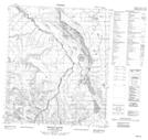
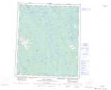
Maps showing Fall Stone Lake, Mackenzie, Northwest Territories
Fall Stone Lake is a Lake located in Mackenzie, Northwest Territories and has an elevation of 281 meters.
- Latitude: 64° 41' 25'' North (decimal: 64.6903700)
- Longitude: 125° 42' 51'' West (decimal: -125.7142719)
- Topography Feature Category: Lake
- Geographical Feature: Lake
- Canadian Province/Territory: Northwest Territories
- Elevation: 281 meters
- Location: Mackenzie
- Atlas of Canada Locator Map: Fall Stone Lake
- GPS Coordinate Locator Map: Fall Stone Lake Lat/Long
Fall Stone Lake NTS Map Sheets