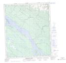
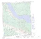
Maps showing Francis Creek, Mackenzie, Northwest Territories
Francis Creek is a River located in Mackenzie, Northwest Territories and has an elevation of 148 meters.
- Latitude: 65° 11' 25'' North (decimal: 65.1903644)
- Longitude: 126° 28' 1'' West (decimal: -126.4670828)
- Topography Feature Category: River
- Geographical Feature: Creek
- Canadian Province/Territory: Northwest Territories
- Elevation: 148 meters
- Location: Mackenzie
- Atlas of Canada Locator Map: Francis Creek
- GPS Coordinate Locator Map: Francis Creek Lat/Long
Francis Creek NTS Map Sheets