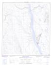
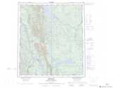
Maps showing Mount Gaudet, Mackenzie, Northwest Territories
Mount Gaudet is a Mountain located in Mackenzie, Northwest Territories and has an elevation of 421 meters.
- Latitude: 63° 20' 35'' North (decimal: 63.3431474)
- Longitude: 123° 35' 51'' West (decimal: -123.5974909)
- Topography Feature Category: Mountain
- Geographical Feature: Mount
- Canadian Province/Territory: Northwest Territories
- Elevation: 421 meters
- Location: Mackenzie
- Atlas of Canada Locator Map: Mount Gaudet
- GPS Coordinate Locator Map: Mount Gaudet Lat/Long
Mount Gaudet NTS Map Sheets