Maps showing Gore Islands, Franklin, Northwest Territories
Gore Islands is a Island located in Franklin, Northwest Territories.
- Latitude: 74° 19' 2'' North (decimal: 74.3171542)
- Longitude: 124° 57' 13'' West (decimal: -124.9534947)
- Topography Feature Category: Island
- Geographical Feature: Islands
- Canadian Province/Territory: Northwest Territories
- Location: Franklin
- Atlas of Canada Locator Map: Gore Islands
- GPS Coordinate Locator Map: Gore Islands Lat/Long
Gore Islands NTS Map Sheets
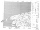
098F Map Not Available Topographic Map at 1:250,000 scale
