Canada Topographic Maps

Hay Creek Topo Maps

Topography maps and Latitude/Longitude Location

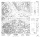
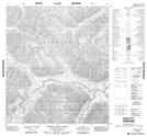
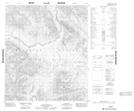
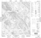
Maps showing Hay Creek, Mackenzie, Northwest Territories

Hay Creek is a River located in Mackenzie, Northwest Territories.

  • Latitude: 64° 9' 00'' North   (decimal: 64.1499899)
  • Longitude: 128° 43' 7'' West   (decimal: -128.7185607)
  • Topography Feature Category: River
  • Geographical Feature: Creek
  • Canadian Province/Territory: Northwest Territories
  • Location: Mackenzie
  • Atlas of Canada Locator Map: Hay Creek
  • GPS Coordinate Locator Map: Hay Creek Lat/Long

Hay Creek NTS Map Sheets

106A02 Anthill Creek Topographic Map at 1:50,000 scale

106A03 Caribou Cry Rapids Topographic Map at 1:50,000 scale

106A06 No Title Topographic Map at 1:50,000 scale

106A07 Ten Stone Mountain Topographic Map at 1:50,000 scale

106A Mount Eduni Topographic Map at 1:250,000 scale

 
Buy Topographic Maps DVD
Newsletter Sign-up

Yes, I want to receive map store discounts.


Bookmark and Share