Maps showing Hell Roaring Creek, Mackenzie, Northwest Territories
Hell Roaring Creek is a River located in Mackenzie, Northwest Territories and has an elevation of 611 meters.
- Latitude: 61° 53' 00'' North (decimal: 61.8832392)
- Longitude: 126° 38' 6'' West (decimal: -126.6350473)
- Topography Feature Category: River
- Geographical Feature: Creek
- Canadian Province/Territory: Northwest Territories
- Elevation: 611 meters
- Location: Mackenzie
- Atlas of Canada Locator Map: Hell Roaring Creek
- GPS Coordinate Locator Map: Hell Roaring Creek Lat/Long
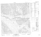
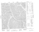
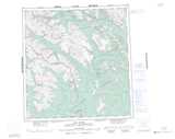
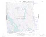
Hell Roaring Creek NTS Map Sheets