Canada Topographic Maps

Johnny Hoe River Topo Maps

Topography maps and Latitude/Longitude Location

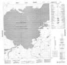
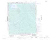
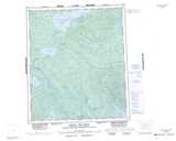
Maps showing Johnny Hoe River, Mackenzie, Northwest Territories

Johnny Hoe River is a River located in Mackenzie, Northwest Territories and has an elevation of 160 meters.

  • Latitude: 64° 49' 1'' North   (decimal: 64.8168257)
  • Longitude: 121° 23' 6'' West   (decimal: -121.3849391)
  • Topography Feature Category: River
  • Geographical Feature: River
  • Canadian Province/Territory: Northwest Territories
  • Elevation: 160 meters
  • Location: Mackenzie
  • Atlas of Canada Locator Map: Johnny Hoe River
  • GPS Coordinate Locator Map: Johnny Hoe River Lat/Long

Johnny Hoe River NTS Map Sheets

095P15 No Title Topographic Map at 1:50,000 scale

096A01 No Title Topographic Map at 1:50,000 scale

096A02 No Title Topographic Map at 1:50,000 scale

096A03 No Title Topographic Map at 1:50,000 scale

096A04 No Title Topographic Map at 1:50,000 scale

096A05 No Title Topographic Map at 1:50,000 scale

096A11 No Title Topographic Map at 1:50,000 scale

096A12 No Title Topographic Map at 1:50,000 scale

096A14 No Title Topographic Map at 1:50,000 scale

095P Keller Lake Topographic Map at 1:250,000 scale

096A Johnny Hoe River Topographic Map at 1:250,000 scale

 
Buy Topographic Maps DVD
Newsletter Sign-up

Yes, I want to receive map store discounts.


Bookmark and Share