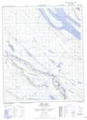
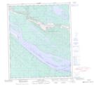
Maps showing Judith Island, Mackenzie, Northwest Territories
Judith Island is a Island located in Mackenzie, Northwest Territories and has an elevation of 49 meters.
- Latitude: 65° 27' 0'' North (decimal: 65.4500712)
- Longitude: 127° 32' 22'' West (decimal: -127.5394077)
- Topography Feature Category: Island
- Geographical Feature: Island
- Canadian Province/Territory: Northwest Territories
- Elevation: 49 meters
- Location: Mackenzie
- Atlas of Canada Locator Map: Judith Island
- GPS Coordinate Locator Map: Judith Island Lat/Long
Judith Island NTS Map Sheets