Canada Topographic Maps

Kamilukuak River Topo Maps

Topography maps and Latitude/Longitude Location

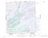
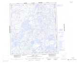
Maps showing Kamilukuak River, Keewatin, Northwest Territories

Kamilukuak River is a River located in Keewatin, Northwest Territories and has an elevation of 307 meters.

  • Latitude: 62° 43' 1'' North   (decimal: 62.7169485)
  • Longitude: 101° 31' 2'' West   (decimal: -101.5171919)
  • Topography Feature Category: River
  • Geographical Feature: River
  • Canadian Province/Territory: Northwest Territories
  • Elevation: 307 meters
  • Location: Keewatin
  • Atlas of Canada Locator Map: Kamilukuak River
  • GPS Coordinate Locator Map: Kamilukuak River Lat/Long

Kamilukuak River NTS Map Sheets

065E02 Three Wives Lake Topographic Map at 1:50,000 scale

065E07 Casimir Island Topographic Map at 1:50,000 scale

065E09 Blue Island Topographic Map at 1:50,000 scale

065E10 Kakarmik Lake Topographic Map at 1:50,000 scale

065E15 Enekatcha Lake Topographic Map at 1:50,000 scale

065E16 Blue Lake Topographic Map at 1:50,000 scale

065L01 No Title Topographic Map at 1:50,000 scale

065L08 Little Rocky Lake Topographic Map at 1:50,000 scale

065E Boyd Lake Topographic Map at 1:250,000 scale

065L Carey Lake Topographic Map at 1:250,000 scale

 
Buy Topographic Maps DVD
Newsletter Sign-up

Yes, I want to receive map store discounts.


Bookmark and Share