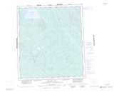
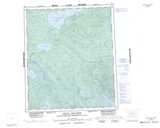
Maps showing Keller Lake, Mackenzie, Northwest Territories
Keller Lake is a Lake located in Mackenzie, Northwest Territories and has an elevation of 247 meters.
- Latitude: 63° 57' 1'' North (decimal: 63.9501420)
- Longitude: 121° 35' 6'' West (decimal: -121.5849416)
- Topography Feature Category: Lake
- Geographical Feature: Lake
- Canadian Province/Territory: Northwest Territories
- Elevation: 247 meters
- Location: Mackenzie
- Atlas of Canada Locator Map: Keller Lake
- GPS Coordinate Locator Map: Keller Lake Lat/Long
Keller Lake NTS Map Sheets
095P13 No Title Topographic Map at 1:50,000 scale
095P14 No Title Topographic Map at 1:50,000 scale
096A03 No Title Topographic Map at 1:50,000 scale
096A04 No Title Topographic Map at 1:50,000 scale
095P Keller Lake Topographic Map at 1:250,000 scale
096A Johnny Hoe River Topographic Map at 1:250,000 scale
095P14 No Title Topographic Map at 1:50,000 scale
096A03 No Title Topographic Map at 1:50,000 scale
096A04 No Title Topographic Map at 1:50,000 scale
095P Keller Lake Topographic Map at 1:250,000 scale
096A Johnny Hoe River Topographic Map at 1:250,000 scale