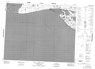
Maps showing Kellett Sandspit, Franklin, Northwest Territories
Kellett Sandspit is a Beach located in Franklin, Northwest Territories and has an elevation of 0 meters.
- Latitude: 71° 57' 56'' North (decimal: 71.9656606)
- Longitude: 125° 55' 56'' West (decimal: -125.9322066)
- Topography Feature Category: Beach
- Geographical Feature: Sandspit
- Canadian Province/Territory: Northwest Territories
- Elevation: 0 meters
- Location: Franklin
- Atlas of Canada Locator Map: Kellett Sandspit
- GPS Coordinate Locator Map: Kellett Sandspit Lat/Long
Kellett Sandspit NTS Map Sheets