Canada Topographic Maps

Kugmallit Bay Topo Maps

Topography maps and Latitude/Longitude Location

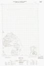
Maps showing Kugmallit Bay, Franklin, Northwest Territories

Kugmallit Bay is a Bay located in Franklin, Northwest Territories and has an elevation of 0 meters.

  • Latitude: 69° 33' 00'' North   (decimal: 69.5499612)
  • Longitude: 133° 35' 10'' West   (decimal: -133.5861036)
  • Topography Feature Category: Bay
  • Geographical Feature: Bay
  • Canadian Province/Territory: Northwest Territories
  • Elevation: 0 meters
  • Location: Franklin
  • Atlas of Canada Locator Map: Kugmallit Bay
  • GPS Coordinate Locator Map: Kugmallit Bay Lat/Long

Kugmallit Bay NTS Map Sheets

107C07E Kittigazuit Topographic Map at 1:50,000 scale

107C07W Kittigazuit Topographic Map at 1:50,000 scale

107C09E Hutchison Bay Topographic Map at 1:50,000 scale

107C09W Hutchison Bay Topographic Map at 1:50,000 scale

107C10W Kidluit Bay Topographic Map at 1:50,000 scale

107C Mackenzie Delta Topographic Map at 1:250,000 scale

 
Buy Topographic Maps DVD
Newsletter Sign-up

Yes, I want to receive map store discounts.


Bookmark and Share