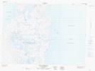
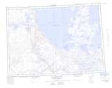
Maps showing Letty Harbour, Franklin, Northwest Territories
Letty Harbour is a Bay located in Franklin, Northwest Territories.
- Latitude: 69° 51' 1'' North (decimal: 69.8502573)
- Longitude: 124° 26' 9'' West (decimal: -124.4357932)
- Topography Feature Category: Bay
- Geographical Feature: Harbour
- Canadian Province/Territory: Northwest Territories
- Location: Franklin
- Atlas of Canada Locator Map: Letty Harbour
- GPS Coordinate Locator Map: Letty Harbour Lat/Long
Letty Harbour NTS Map Sheets