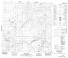
Maps showing Lobstick Creek, Mackenzie, Northwest Territories
Lobstick Creek is a River located in Mackenzie, Northwest Territories.
- Latitude: 60° 6' 1'' North (decimal: 60.1001493)
- Longitude: 112° 34' 49'' West (decimal: -112.5802666)
- Topography Feature Category: River
- Geographical Feature: Creek
- Canadian Province/Territory: Northwest Territories
- Location: Mackenzie
- Atlas of Canada Locator Map: Lobstick Creek
- GPS Coordinate Locator Map: Lobstick Creek Lat/Long
Lobstick Creek NTS Map Sheets